843-999-2661
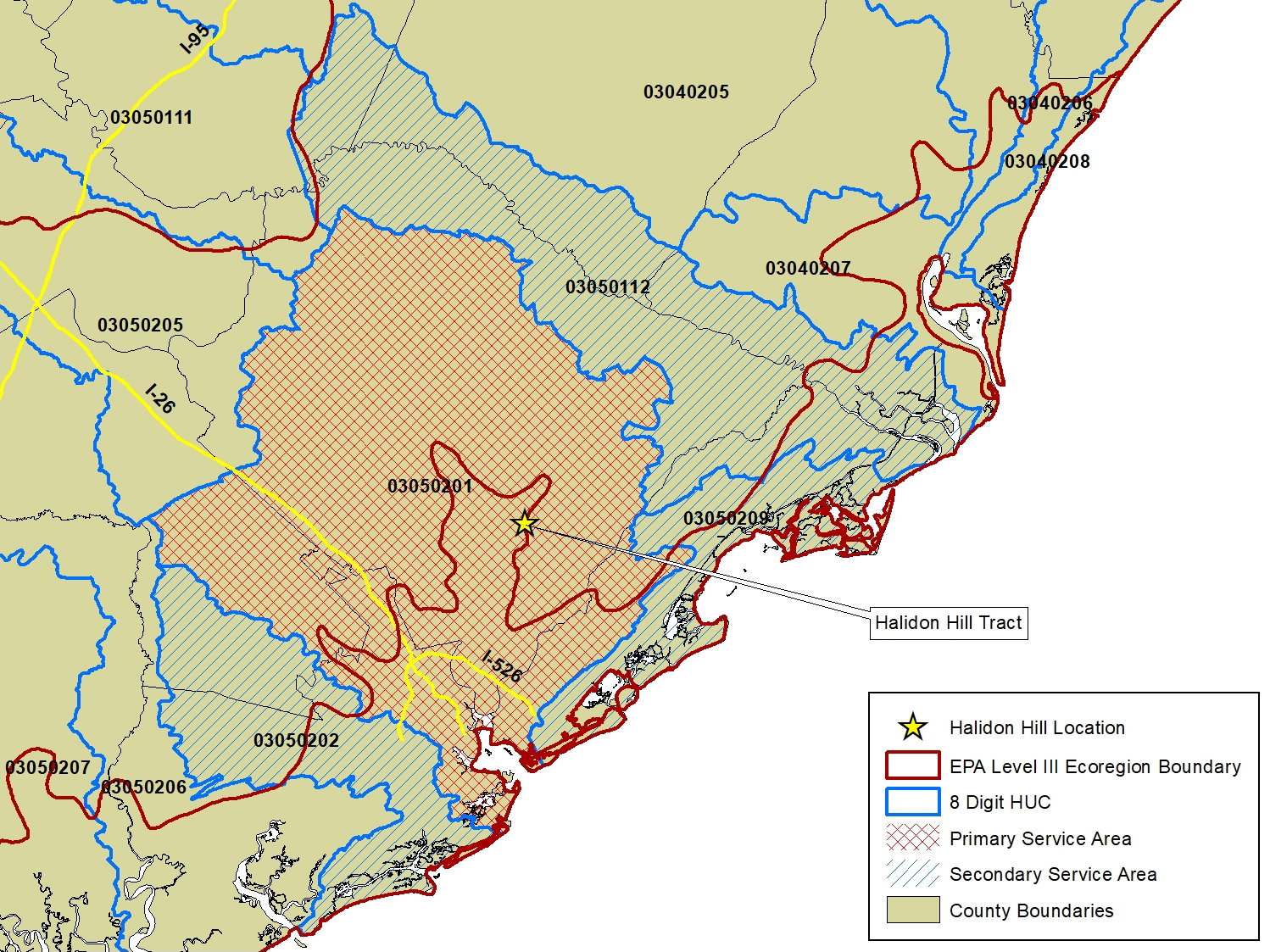
Halidon Hill Mitigation Bank is a 1,328.4-acre mitigation bank that is located on a 1,744-acre tract adjacent to the East Branch of the Cooper River in Berkeley County, SC. The Bank is in the Cooper watershed, 8-digit Hydrologic Unit Code 03050201. The property contains a series of historic rice impoundments that bisect the bank. The Bank is located within the Middle Atlantic Coastal Plain Level III Ecoregion.
The Halidon Hill Mitigation Bank will be comprised of approximately 1328.4 acres including upland buffers, historic rice fields, reserves, freshwater wetlands, streams and drainage ditches that will be preserved, enhanced and/or restored to wetlands or tributaries. When construction is complete, the Bank will protect approximately 1,083.4 acres of freshwater wetlands and historic rice fields, as well as 20,370 LF of jurisdictional streams. The Bank will also protect approximately 245 acres of non-jurisdictional lands (upland buffers) that contribute to the ecological functioning of jurisdictional aquatic resources within the Bank.
| Primary Service Area | 8-digit HUC # |
|---|---|
| Cooper River | 03050201 |
| Secondary Service Area | 8-digit HUC # |
| Santee River | 03050112 |
| Bulls Bay | 03050209 |
| South Carolina Coastal | 03050202 |